 |
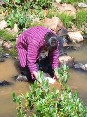
Emerald jade specimen with quartz crystals from Wyoming. To identify the quartz, first look at the crystal in the bottom
center of the jade. Count how many crystal faces you see. There are 6, meaning it is hexagonal. Quartz is hexagonal and
often white to transparent. Another clue comes from the crystal to the left and little above. It lies perpendicular to the first
crystal and suggests the crystal has long prime capped by a pyramid - just like quartz. To verify that you have jade, you
can test the hardness, but one of the only ways to verify is to have it x-rayed because we have no visible crystal structure
(which is typical of jade). |
Rock Hounding Wyoming (modified and revised with permission from Planet News)
Wyoming was considered the poorest of all states for gemstones and rocks until recently - it even had a worse reputation than Florida and Louisiana for rock hunting - two states that have practically no rocks - just a lot of limestone, dirt and swamps – so what happened? It started in 1975. At the time,
Jade was king. Impressive jade boulders were found near Jeffrey City in central Wyoming, but otherwise, nothing of note had been found in the Wyoming cow pastures other than a few agates, jasper, coal, oil, gas, bentonite and uranium. Then Dr. Mac McCallum and Chuck Mabarak from Colorado State University sampled a newly discovered kimberlite (diamond) pipe in Wyoming. A sample was sent to the US Geological Survey - Eureka! Several tiny microscopic diamonds were found by accident! McCallum went on to make a name for himself and became respected internationally as one of the top diamond researchers in the world - so what did Colorado State University do to this productive geologist - they gave him the boot. Politics! Dr. McCallum also brought to light that Wyoming had a major palladium and platinum deposit at the New Rambler west of Laramie. So, the seeds were planted and discoveries were made. But what CSU moron let this geologist go?
 |
| Panning for diamonds & gold |
Wyoming never looked back after these discoveries. Then another geologist came on the scene. This geologist dreamed of treasure. Professor Dan Hausel with the Wyoming Geological Survey became known as a discoverer. For the next 30 years, he made new discoveries nearly every year! Imagine one person making new discoveries over 3 decades in a place where only the deer and the antelope roamed. We'll just refer to him as the Professor. He put Wyoming on the map!
 |
One of two piles of more than 13,000 carats of gem peridot
recovered from just two anthills in the Leucite Hills) in 1997. |
People usually get the impression everything has been found. Not so! Discoveries were made in Wyoming every year from 1977 to 2007 because of the Professor. When he left Wyoming - the discoveries dried up - not a single discovery has been reported since 2007! But the Professor was not alone. Other geologists made discoveries including Ray Harris, Robert Houston, and J.D. Love!
Diamonds were accidentally discovered in 1975, and more than 40 diamond deposits (known as kimberlite pipes) were found along the Colorado-Wyoming border. Over the years, these yielded more than 130,000 diamonds mostly from bulk sample tests (including sizable diamonds weighing >28 carats). In addition, more than 600 high-quality crypto volcanic anomalies were found by the Professor that suggest Wyoming, Colorado and Montana are underlain by a diamond province of unparalleled size. Now here's where you come in. As a prospector and rock hound, start researching these and Walla - you may become the next DeBeers!
Back to the Professor. While working for an international diamond company, he found another group of 50 depressions along Interstate 80, within sight of the state capitol. Are these diamond pipes? They sure look like they could be. But to this day, they still have not been drilled or sampled.
Before finding these depressions, the Professor was looking for diamonds in the Leucite Hills near Rock Springs but he found another gemstone everyone else missed.
Peridot! He took 13,000 carats along with many angry ants from their anthills and from outcrop at Black Rock - this was the first time peridot had been described in Wyoming! And now, many rock hounds have taken advantage of his discovery and collected this beautiful gemstone.
In 1981, he predicted gold would be found near Casper - simply by studying the geology. This became one of the more impressive finds in the past century in Wyoming, and will end up in a major gold mine some day. Imagine you are a gold prospector. You find a gold deposit! How do you feel? Well the professor not only found a gold deposit, he found a whole new gold district that everyone else missed. Gold districts have many gold deposits with similar deposits in a small geographical area and the Professor predicted this one would also have a major gold deposit along with many other gold deposits. This became known as the Rattlesnake Hills gold district. Geologically, it is what geologists call a
greenstone belt (also known as gold belts in Australia, Canada and Africa). Not only did the professor find the
Rattlesnake Hills greenstone belt, he found gold at several other locations and then mapped the
South Pass greenstone belt and
Seminoe Mountains greenstone belt and not only found gold in these belts, but also in the Elmers Rock greenstone belt. We may never know how many gold deposits the Professor found, but it is clear he found dozens! And with the mapping of the greenstone belts, the GemHunter also provided a clear picture of Wyoming greenstone belts (or gold belts). Thus, Dr. Robert Houston, Dr. Paul Graff, Dr. Karl Karlstrom, Dr. George Snyder and the GemHunter (Professor Hausel) gave future generations a picture of Wyoming's Precambrian geology that simply did not exist before these pioneers.
Following the discovery of several significant gold anomalies at the Rattlesnake Hills greenstone belt, mining companies and consultants flocked to the area to explore and discovered other gold deposits. After more than 3 decades of drilling, a significant, large-tonnage, low-grade gold deposit was found at Sandy Mountain: right where the Professor told the University of Wyoming Research Institute it would be - but Wyoming refused to provide any increased funding for this kind of research.
 |
A large (34 ounce) gold nugget recovered from Rock Creek
in the South Pass greenstone belt of Wyoming.
|
The Professor predicted at least two generations of gold deposits would be found in this greenstone belt - gold associated with very old (Archean age) greenstone rocks and gold associated with replacement deposits, breccia pipes, and with younger volcanic rocks (Tertiary age). In other words, the Rattlesnake Hills has the best of both worlds. Greenstone belts are well-known for rich gold deposits, such as
Yilgarn greenstone belt in Australia, which hosts 30% of the world's gold reserves and 20% of the world's nickel reserves. And the associated breccia pipes related to younger volcanic rocks are similar to gold deposits mined at
Cripple Creek, where more than 23 million ounces of gold have been mined. Will the Rattlesnake Hills turn into another
Kalgoorlie or Cripple Creek?
Following the GemHunter's discoveries, a few companies drilled. ACNC found more gold: Newmont Gold found a million ounces at Sandy Mountain, but walked away from a >$1 billion gold deposit. Another company recently began exploring Sandy Mountain and hit more gold! Lots of gold. It looks like they could have another Cripple Creek. The Professor felt he had found a giant breccia pipe between Sandy Mountain, Oshihan Hill and Goat Mountain - the mother lode but could not get funds from Wyoming to drill.
 |
| The Duncan gold mine at South Pass, Wyoming. |
The Professor wrote about many of his discoveries in
more than 1000 books, papers, and abstracts and was in
demand for talks and lectures and traveled all over North America to mining conferences and to visit various rock hound groups to tell the rest of the world about Wyoming. He became the spokesman for Wyoming's mineral resources and brought in dozens of mining companies, consultants and others who spent $millions in Wyoming in the search for the mother lode. It could easily be argued that no one in Wyoming had been more productive in the historic past when it came to increasing our understanding of Wyoming's mineral resources.
While mapping
South Pass in the mid to late 1980s, the Professor made many more discoveries and wrote another book “Economic Geology of the South Pass Granite-Greenstone Belt, Wind River Mountains” (1991). Not only did we find quartz with visible gold using this book, we came across people who attended some of the Professor's field trips and had picked up specimens that should be in museums. The Professor gave his free time to teaching others about geology and prospecting in more than a hundred field trips and free seminars. Because of the Professor, Wyoming became Rock Hound heaven.
 |
Mining gold from the dry placers at Dickie Springs. Prospectors follow up
on Dr. J.D. Love's research south of South Pass.
|
In South Pass, he predicted
the Carissa mine would be a multi $billion gold deposit. It could be one of the largest gold deposits in the West. So what did the State of Wyoming do, they purchased it for an undisclosed amount with your taxes and made it into a picnic ground so no one could ever mine it again!
Now we see the footprints of Dr. J.D. Love. Dr. Love made many discoveries and is best known for his work on uranium as well as putting together a detailed geological map of Wyoming. In the South Pass area, he and two other members of the US Geological Survey researched the Oregon Buttes area to the south of South Pass and predicted (based on sampling and drilling) that this area has 28.5 million ounces of gold! It all remains mostly untouched. He also found a similar deposit with Jack Antweiler to the north at McGraw Flats!
Back to the Professor - The GemHunter rediscovered gold in the
Seminoe Mountains in 1982. An honest to goodness rush followed as hundreds of geologists and prospectors flocked to the area. Then he found gold in the Sierra Madre, the Medicine Bow Mountains - more rushes.
 |
A petrified Sequoia tree in the Wasatch Formation near Buffalo, WY (photo
by Wayne Sutherland, 1979). |
Then he went to Alaska as a geological consultant in 1988 and 1989 for West Gold thanks to his friend Dr., Paul Graff. While
searching for gold, one of the largest gold deposits in the history of North America was found. Seven geologists (three from Wyoming) found a gold deposit that now is reported to contain more than 41 million ounces of gold! The Donlin Creek deposit, when mined, will produce 1.5 million ounces a year and will be one of the largest gold mines in history. To give a proper perspective of how huge this gold deposit is, particularly those who are fans of the reality show GOLD RUSH, the Donlin Creek discovery is so enormous that it contains more than twice the amount of gold mined throughout the entire history of the Yukon! It also contains more than 120 times the amount of gold mined in Wyoming throughout its entire history! So, my advice to any prospector: follow the Professor around in the field – he will find something else.
Over the years, prospectors and treasure hunters found many gold nuggets in Wyoming. A 7.5-ounce nugget was found at South Pass by a rock hound. Another treasure hunter from Colorado found more than 100 nuggets in Wyoming, another from Arizona recovered 399 nuggets in the Sierra Madre, and then there was a 34 ounce nugget found in the 1930s and a boulder full of gold found before then. Yes, there is gold in the Windy state. But there is more. In 1995, the Professor found platinum, palladium, gold and nickel at Puzzler Hill near Saratoga. How did everyone else miss this and all of the other discoveries - such as the largest iolite deposits and samples found on earth?
GEMS HERE THERE & EVERYWHERE A few gems were found in Wyoming besides jade: agates, jasper, a beautiful 2-foot long aquamarine from Anderson Ridge found by the late Elmer Winters. But when the GemHunter focused on gems, he made history, and there is little doubt if he had remained in Wyoming, dozens of more gemstone and gold deposits would gave been found by now.
 |
| Extraordinary jade from Wyoming |
Several diamond deposits, pyrope, chrome diopside, peridot, spessartine, kyanite, ruby, sapphire, apatite, helidor, aquamarine, giant jasper deposits, common opal, fire opal, amethyst, precious opal, iolite - gems that were not suppose to be in Wyoming were found by the GemHunter. The discovery of gold in the Rattlesnake Hills and in Alaska were quite impressive discoveries, but then there were the fabulous and world-class iolite gem deposits found in the central Laramie Range.
It is said, that it is extremely rare for a person to find one world-class deposit - after all, there have only been a few dozen found throughout history. Yet, the Professor was part of the discovery team that found a world-class gold deposit in Alaska, he found a major gold district in the Rattlesnake Hills and then he found two world-class iolite deposits. He also identified significant gem kyanite deposits, a significant fire opal deposit (even though common opal had been mentioned in passing in the area by geologists of the USGS in the 1930s) and mapped opal and agate in parts of 16-sections of land, and then he mapped the two largest diamond-bearing kimberlite districts in the US, discovered a formerly unknown kimberlite district (Sheep Rock district), mapped the largest lamproite field in North America, and mapped the 250-square mile South Pass greenstone belt, the Seminoe Mountains greenstone belt, the Rattlesnake Hills greenstone belt, the Cooper Hill district and parts of the Silver Crown gold-copper district. In total, he mapped more than 600 square miles of geology in Wyoming.
 |
At the time of discovery, this iolite specimen was the largest, single iolite
gemstone in the world. The gem weighed 1,750 carats and found by
the GemHunter in 1995.
|
Iolite discoveries. Iolite looks like tanzanite - only better to some collectors. It is an extremely rare, sapphire to violet blue gem. In 1995, the Professor found this gem with ruby, sapphire and kyanite and at the time, recovered the largest
iolite gemstone in the world, a fist-sized specimen of 1,750 carats. This large iolite gemstone was found at Palmer Canyon to the west of Wheatland by the GemHunter. In addition to this gem, he recovered several dozen iolite gemstones, with many weighing a few hundred carats each. Nearby, ruby, pink sapphire and sky blue kyanite gemstones were also recovered.
 |
Some of the first iolite and ruby gems
faceted from Palmer Canyon rough.
|
Then in 2004, the GemHunter
found an iolite gemstone that weighed 24,100 carats at Grizzly Creek a few miles south of Palmer Canyon. There were much larger gemstones but he couldn't figure out how to place a gemstone weighing more than a million carats in his back pack! That's right, gemstones so large that it will require serious mining to get them out. He had predicted this deposit would occur based on geology and even wrote about it in 2000.
Then he came across the Sherman-Raggedtop
iolites. Based on geology, this one could potentially host more than 2 trillion carats of iolite! But the Professor moved on before much could be done on this deposit after he discovered it. But based on exploration prior to the second world war, the Wyoming Geological Survey had estimated that this deposit contained more than 500,000 tons of cordierite - it was all assumed to be industrial grade. So, the GemHunter went searching and found very high-quality gem iolite along the edge of the deposit - every specimen he collected was a gemstone. Thus, if only part of this deposit is gem-quality, we are talking about trillions of carats of gemstones! Almost enough to pay for part of the Obama National Debt. But this deposit remains mostly untouched. According to the GemHunter, there are likely several more gem iolite deposits in this part of the Laramie Mountains.
 |
| Some Sweetwater agates found in the opal fields of Wyoming. |
Opal Discovery. Opals? The GemHunter mapped one of the largest opal deposits in North America south of Riverton. Opals everywhere – some are larger than 100,000 carats sitting right next to the state highway! While mapping, he found billions of carats of common opal, agate, Sweetwater agate, the first fire opals reported in Wyoming, and the first precious opal verified from Wyoming. So kick around a few rocks, and keep your eyes open, you are likely to find a new mineral deposit or occurrence, maybe even a whole new district. But the GemHunter didn't find this deposit. It had been mentioned in passing in a couple of early publications by the US Geological Survey that some rocks were opalized, but no other descriptions. While talking to a rock hound group in Riverton, a rock hound had mentioned he had picked up some opal in the area, so the GemHunter decided to go have a look and he found boulders of common opal sitting along the side of the roads, an entire hillside of fire opal, and a few traces of precious opal along with all kinds of agates and Sweetwater agates. It was just another example of no one every bothering to look. An recently, the GemHunter believes he may have identified another similar deposit near Douglas Wyoming that is described in his
recent gemstone book. If he were still in Wyoming, no doubt another significant gem deposit would have been identified by now, but instead, the deposit sits near the Interstate gathering dust. Makes one wonder?
 |
| Specularite with malachite from the Hartville uplift, WY |
HISTORY OF PROSPECTING The following is summarized from a free pamphlet on rock-hounding published by the Wyoming Geological Survey. Gold was found by Spaniards 200 years ago in Wyoming. However, recorded history indicates that gold was discovered in Wyoming in 1842. Fur trappers found gold in streams in the Wind River country, which at the time was part of the Northwest Territory. Several years later, in 1863, immigrants passing near Oregon Buttes along the Oregon Trail to the south reported finding gold along the trail. Four years later, after the region had been made part of the Dakota Territory, prospectors working further north discovered a rich lode along Willow Creek at the base of the Wind River Mountains. This led to the sinking of the Carissa shaft. South Pass City was organized within site of the gold mine.
Hundreds of prospectors rushed to South Pass. Reports vary, but 2,000 to 10,000 may have populated South Pass City at the peak of the rush. Gold was soon discovered at several nearby localities. Other towns rose from the dust. Hamilton City (Miners Delight) and Atlantic City reported populations of 1,500 and 500 people, respectively. Pacific City to the south claimed a population of 600. A few years later, after the region became part of the Wyoming Territory, gold discovered on Strawberry Creek led to the establishment of a town named Lewis Town (also known as Lewiston). Soon Wyoming recorded other gold discoveries in the Seminoe Mountains, the Medicine Bow Mountains, and the Sierra Madre and in the Black Hills. Gold has been found in every mountain range in the state and many streams draining these regions also have gold!
 |
Copper-gold-silver ore from the Ferris-Haggarty mine,
Encampment district, Sierra Madre. This rich copper sample
is an example of mill rock that is found adjacent to volcano-
genie massive sulfide deposits. |
Gold was King until near the end of the 19th Century. Then it found a Queen with rising copper prices and copper rose high enough it was considered a precious metal by prospectors. Rushes to the Absaroka Mountains, Sierra Madre, Medicine Bow Mountains, Owl Creek Mountains, and Laramie Range brought many prospectors to Wyoming. About the only major discovery was the
Ferris-Haggarty in the Sierra Madre. To recover the rich ore, a 16-mile long aerial tramway was built to haul ore from over the continental divide from the mine on the west side of the range, to the Boston-Wyoming mill and smelter complex at the town of Riverside on the east side of the range. Copper was followed by platinum, palladium, asbestos, manganese, titanium, uranium, iron, coal, trona, bentonite, oil, gas and jade. Dr. David Love and Ray Harris made several uranium discoveries.
WHAT TO LOOK FOR Some general localities are described. A good addition to the reading list would be a descriptive rock and mineral reference book to help you identify some of the more difficult minerals.
Agates, Jasper, Petrified Wood Agate, jasper, and petrified wood are forms of chalcedony. Chalcedony is a compact or massive form of silica. Commonly, it forms by precipitation of silica-rich solutions as veins, as cavity linings, or by replacement in a wide variety of rock types.
 |
| Goniobasis agates from Delany Rim, Red Desert |
By definition,
agate imparts a distinct color banding resulting from impurities trapped in the silica as it crystallizes, and petrified wood results when the original woody material is replaced by silica-rich solutions, usually during rapid burial by silica-rich volcanic ash. Jasper is a brightly colored (red, brown, yellow) form of chalcedony.
Several distinctive varieties of chalcedony found in Wyoming are given descriptive or geographical names by rock hunters. Some are so distinctive that many rock hounds can give you the geographical location within in a few miles of where the sample was collected by merely looking at a hand-size sample.
Varieties of banded agate include Rainbow agate, which diffracts light into a rainbow spectrum of colors when thinly sliced. Rainbow agate is found in the Wiggins Formation in the southern region of the Absaroka Mountains near Yellowstone, and in gravels along the Wind River north of Riverton. A red and white banded agate known as Dryhead agate is found along the Bighorn River northeast of Lovell and in sediments eroded from the Hartville uplift northeast of Gurnsey.
One of the more popular agates found in Wyoming is a very distinct and attractive agate, known as the Youngite. This is a very attractive, pink, silicified breccia cemented and coated with grey to blue-grey banded chalcedony. Youngite agates have only been found in eastern Wyoming in the Hartville uplift near Gurnsey.
 |
| Banded chalcedony from the Commonwealth mine, Arizona |
Moss agates have a distinct dendritic pattern from iron oxide or manganese oxide in white to blue chalcedony. A distinct agate known as Sweetwater agate contains manganese oxide dendrites in dark blue to dark gray-blue chalcedony.
Sweetwater agates are found along the Sweetwater River and Sage Hen Creek west and northeast of Jeffrey City, respectively. For many years, no one could find the source terrain for the famous Sweetwater agate until it was discovered by professor Hausel when he was sampling and mapping the Cedar Ridge opal deposit south of Riverton.
The better places for
petrified wood include the Absaroka Mountains, a place 35 miles north of Medicine Bow, along State Highway 130 between Saratoga and Walcott, and northeast of Farson. The most coveted samples are near Farson, known as the Blue Forest wood. These have cores of silicified wood enclosed by a light-blue to sapphire-blue chalcedony. In this same region, rock hunters used to find stumps of petrified trees standing more than 6 to 8 feet tall a century ago.
Goniobasis agate is a rock composed of dark-grey to black silicified fossil snails known as goniobasis gastropods. These rock agates are found in the Green River- Granger area north of Interstate 80 in Sweetwater County. Many other specimens have been found along Delany Rim near Tipton and Red Desert just south of Interstate 80. The better samples are dark brown to black in color, which in part is due to silicification.
 |
| Jasperoid breccia from the Granite Mountains |
Jasper is reddish to tawny chalcedony, and is mineralogically and chemically identical to agate, with the exception of trace metals which impart the reddish to tawny color. Many jaspers have been found in the state, but some of the better known localities are in the Granite Mountains in central Wyoming. Two extraordinary localities occur in the Tin Cup and the Rattlesnake Hills districts. Professor Hausel identified an extraordinary jasper deposit in the Rattlesnake Hills which actually has some fossil leaves impressed in the jasper. The jasper mapped by him in the Tin Cup area is worth seeing. The jasper was exposed in an old mine and the mine and tailings are covered by some of the prettiest jasper and jasper breccia mankind has ever seen.
COPPER
Deep green to blue stains on many rocks in mine districts usually are copper carbonates known as malachite and azurite. A bronze colored metallic mineral with a patina of purple and blue is known as chalcopyrite. When the copper weathers, they produce a copper-stained gossan that is a good place to look for visible gold. Some gossans cap copper-enriched zones at shallow depths where the water table is encountered. Gold, silver, lead, zinc and molybdenum may be found in association with copper.
 |
Azurite (blue) with goethite and limonite (yellow and brown). Azurite is a
copper carbonate and will fizz just like a soda pop when dilute hydrochloric
acid is dropped on it. Another way to test for most copper minerals is to wet
the suspected minerals with dilute hydrochloric acid and then vigorously rub
a well-used (not new) rock hammer into the wetted copper mineral. If it is
copper, it will deposit a thin coating of native copper on your rock pick.
Sample collected from the Kirwin area, Absaroka Mountains, Wyoming. |
About 30 million pounds of copper were mined in Wyoming’s past. Most was from the Encampment District, where several mines were developed to support the Boston-Wyoming smelter and mill complex at Riverside. One of the more famous was the Ferris-Haggarty. Ore from this mine was shipped from the mine site along Haggarty Creek in an aerial tramway. The tram ran from the mine, up the western slope and over the continental divide of the Sierra Madre, and down the eastern slope to a mill at Riverside. Some high-grade ore from the mine was incredibly rich containing 30 to 40% copper. For comparison, some of the major modern copper mines of today produce ore that has only 0.7% copper. In this same region, Professor Hausel found several massive sulfide copper deposits. Others were found by Conoco Minerals and a grad student from the University of Wyoming (Swift). So, the government decided to place many of these into roadless areas so they could no longer be explored.
Copper is also found in many other places in the state including the Absaroka Mountains in northwestern Wyoming. In the Absarokas, giant, copper deposits contain millions of tons of low-grade copper, with silver, gold, some zinc, lead, molybdenum and titanium that are worth more than $5 billion. And thanks to Uncle Sam, these now lie within wilderness, roadless and other areas that keep prospectors and rock hounds from prospecting.
 |
Specularite (hematite) with bronze-chalcopyrite (copper-iron-sulfide) from
Puzzler Hill, Wyoming |
Chalcopyrite (copper-iron-sulfide) is a brassy-orange, brittle, metallic mineral that weathers to limonite and a variety of copper minerals including malachite, black tenorite, and earthy red cuprite.
Malachite, a light- to dark-green copper carbonate, will react with dilute (10%), hydrochloric acid (Muriatic acid, a very weak form hydrochloric acid, will also work) by emitting bubbles of carbon dioxide, similar to the fizz in soda pop. If you place the same acid on tenorite or cuprite; you will find a thin plate of native copper will replace a well-used rock hammer after rubbing the hammer into the acid.
A GIRL'S BEST FRIEND
Diamonds, diamonds, diamonds! Diamonds are apparently recovered from streams as well as from a very rare rock known as
kimberlite and sometimes from two of the rarest rocks on earth - lamproite and lamprophyre. Colorado, Montana and Wyoming have all three of these rocks and any prospectors should learn how to recognize them.
 |
Raw diamonds from kimberlite - diamonds can be verified by using a simple
tool known as a Diamond Detective. Some diamonds are priceless, and others
have little value. |
Some diamonds are the most valuable commodities on earth. Rare diamonds are valued at 200,000 times an equivalent weight in gold! Thus for their size, diamonds can be an extremely valuable commodity. Diamonds and other gems are mined from two rare rock types – kimberlite and lamproite, both of which are abundant in Wyoming. For instance, Wyoming has the two largest known fields of kimberlite in the US and the largest lamproite field in North America. Geological and mineralogical evidence supports that many more kimberlites and lamproites will be found in Wyoming. To date, most of the kimberlites that have been tested in Wyoming have either yielded diamonds, or favorable chemistry for diamonds.
 |
| Kimberlite sample |
The first diamond pipe was found in Wyoming in 1960; but, the diamonds themselves were not discovered until 1975. Since then, more than 130,000 diamonds have been mined in a region south of Laramie extending from Tie Siding, Wyoming to Prairie Divide, Colorado. A large percentage of the diamonds that have been mined have been high-quality gemstones. A few diamonds larger than 28 carats have been recovered from the Kelsey Lake diamond mine along the Colorado-Wyoming border. The largest known diamond found in Wyoming weighed more than 6 carats.
Read about diamonds in a 1998 book “Diamonds & Mantle Source Rocks in the Wyoming Craton with Discussions of Other US Occurrences” and a 2002 book entitled “Diamond Deposits - Origin, Exploration and History of Discovery”.
JADE
Jade includes two mineral species: nephrite and jadeite. only nephrite jade is found in Wyoming. But it has been found in such abundance that it is considered synonymous with "Wyoming Jade", even though it is found elsewhere in the world.
 |
Kimberlite with a large chrome diopside megacryst. Kimberlite is not
easy to identify, so you are going to need help with this rock.
It is a very rare rock that contains enough calcium carbonate
that it will react with dilute hydrochloric acid by fizzing.
Kimberlite volcanoes erupt giving off considerable amounts
of carbon-dioxide (that natural stuff that plants need to survive
and the EPA recently listed as a pollutant). Much of the carbon
dioxide is released into the atmosphere while a little precipitates
as calcium carbonate in the rock. |
Many similar appearing rocks are mistaken for nephrite, such as rounded, stream-worn or wind-polished cobbles of dark gray to green amphibolite, metadiabase, epidotite, quartzite, serpentinite, and leucocratic (white) granite. These rocks can be distinguished from jade by any number of tests including some simple field observations. For example, amphibolite, metadiabase, and leucocratic granite typically have a granular texture that is lacking in jade; the freshly broken surface of quartzite tends to sparkle in sunlight due to the reflection of light off individual quartz grains; epidotite has a distinct pistachio green color and perfect cleavage; and serpentinite is relatively soft and often can be easily scratched with a pocket knife. In addition, serpentinite contains pockets of magnetite and is weak to moderately magnetic, unlike jade.
Nephrite jade is extremely tough and resistant to fracturing. As a result, rounded boulders of nephrite are nearly impossible to break with a hammer. Because of toughness and attractive appearance, nephrite, which has been termed the "axe stone", has been prized since prehistoric times.
 |
| Polished jade from Wyoming |
Only carbonado, a black granular to compact industrial form of diamond is tougher than jade. However, gem-quality diamond lacks the toughness of jade and is easily smashed with a hammer. It is the toughness of jade, combined with its hardness that makes the gemstone carvable and durable.
Its hardness, ranges from 6 to 6.5 (or about the same hardness as a steel file). The green color in nephrite jade is the result of iron within the crystal lattice. When iron is absent, the mineral is practically colorless to cloudy white, resulting in a variety known as ‘muttonfat jade’. Other colors also depend on the abundance of iron in the crystal lattice, and these include translucent, emerald-green ‘imperial jade’; ‘apple-green’ jade, ‘olive-green’ jade, ‘leaf-green‘ jade, ‘black‘ jade, and ‘snowflake’ (mottled) jade. The greater commercial values are attached to the lighter green, translucent varieties.
Deposits of nephrite jade are accompanied by distinct alteration mineral assemblage that can be used to help locate hidden jade deposits. Where found, the jade is accompanied a distinct, mottled pink and white granite-gneiss with secondary green clinozoisite, pink zoisite, pistachio green epidote, green chlorite, as well as white plagioclase which is pervasively altered to white mica.
When found, jade may be covered with a cream to reddish-brown weathered rind. But when naturally polished with a high-gloss waxy surface, known as 'slicks', the jade is usually recognizable.
RUBY
Sapphire and ruby are gem corundum. Corundum the second hardest known naturally occurring mineral, can be recognized because it will only be scratched by diamond, and is usually found as hexagonal prisms with distinct rhombohedral cleavage.
 |
| Rubies cut from red corundum from Palmer Canyon, WY |
The deep red variety of corundum is termed ruby. All other colors of gem-quality corundum are known as sapphires – thus sapphire can be blue, green, pink, yellow and white. Some rare varieties of corundum may contain small mineral inclusions of rutile aligned in specific, crystallographic directions forming three lines oriented 120° to one another. These will produce a star effect when light if reflected from the mineral, and are known as star rubies, or star sapphires.
Gem quality sapphires and rubies are rare; however, a few crystals (including star rubies) have been reported from in the Granite Mountains north of Jeffrey City. Other rubies and sapphires have been found in the Palmer Canyon area of the Laramie Mountains west of Wheatland. Professor Hausel discovered that many of the Wyoming ruby and sapphire deposits occurred in a rock type known as vermiculite. Using this information, he found a half-dozen ruby deposits in vermiculites in Wyoming.
GOLD
Gold is heavy, malleable and warm yellow metal. When scratched with a knife, the yellow flake or nugget will have a distinct gold-colored indentation.
Gold is also very heavy, and is 15 to 19 times heavier than water. For comparison, quartz is only about 2.8 to 2.9 times heavier than water.
In lodes, gold is often found with sulfide minerals. These may include pyrite (iron-sulfide), also known as fool's gold, arsenopyrite (iron-arsenic-sulfide), and chalcopyrite (copper-iron-sulfide). Pyrite can fool many people. It is often mistaken for gold; however, pyrite is much lighter and forms brass-colored, brittle crystals that often have cubic (6-sided) or pyritohedral (12-sided) habit. Unlike gold, pyrite is not malleable and can be easily crushed to a dark greenish-grey powder by striking the mineral with a rock hammer. Scratching a streak plate (a rough, white piece of tile) with pyrite will also leave a distinct black streak of powder on the tile.
But pyrite sometimes contains hidden gold within its crystal structure - it can hide as much as 2,000 parts per million gold (this would be equivalent to a ton of pyrite containing about 60 ounces of gold). The gold in the pyrite would not be visible; unless some the mineral had oxidized and was replaced by limonite (a hydrated iron-oxide that is essentially rust) producing what is known as gossan, or boxworks.
 |
| Gold found in Douglas Creek, Wyoming |
A gossan is essentially a reddish- to yellowish-brown, iron-rich mass found in some veins and faults. Gossans provide excellent places to search for gold, since limonite produced by the oxidation of gold-bearing pyrite, may contain specs, rods, or masses of visible gold. The better places to look for visible gold in gossans are in web-like, honeycomb, vuggy zones known as boxworks. Boxworks result from oxidation and removal of the pyrite, leaving behind silicified ridges, or outlines of the former crystals. Gold, however, being relatively inert, will remain in place, and can sometimes be found on the boxwork ridges.
Other sulfides found with gold include arsenopyrite and chalcopyrite. Arsenopyrite, a brittle, silver-metallic, mineral, will oxidize to a greenish-yellow limonite known as scorodite. When arsenopyrite is struck with a rock hammer, a garlic odor will be detected. This is due to arsenic in the sulfide. Some arsenopyrite can potentially hide as much as 1,000 ppm gold in its crystal lattice.
One mineral that is more often mistaken for gold than pyrite, is mica. Mica is often found in both lodes and placers. Each year dozens of people bring samples of mica to the WGS believing they have found the 'mother lode'.
 |
Note the reddish brown rock in the back ground of this photo taken in the
San Juan Mountains of Colorado - this is an excellent gossan |
In general, gold is found in lodes and placers. The term 'lode' simply describes an in situ mineralized vein or fault as opposed to a placer, which consists of reworked, detrital, heavy minerals concentrated in active or inactive stream gravels. Veins generally form narrow sheets of quartz, whereas most faults consist of vertical to near vertical sheets of intensely deformed rock that often contain quartz veinlets and boudins (lenses). When mineralized, the gold values in lodes are typically erratic along much of the length of the structure and random sampling may yield only trace amounts of gold. However, periodic ore shoots (enriched zones) are sometimes encountered. Some of these pockets may average more than 1 ounce of gold per ton. At such high grades, the gold will often be visible to the naked eye and individual pieces of rock may produce specimen-grade samples, especially when ore grades run higher than 1 ounce per ton.
Gold has been found in all of Wyoming’s mountain ranges as lode and/or placer deposits. Some of the better places to search for gold include the Wind River, Seminoe Mountains, Medicine Bow Mountains, Mineral Hill, and Sierra Madre.
The best place to search for specimen grade gold samples in Wyoming is the
South Pass district, along the southeastern margin of the Wind River Mountains. The district encloses several gold-bearing faults (shear zones) and some veins. Many of these are located on maps published by the Wyoming Geological Survey, and there thousands of feet of gold-bearing shears in this region that have never been seriously prospected!
This area is also a good place to search for specimen-grade samples. For example, some ore recovered from the Carissa mine in 1908, assayed as high as 260 ounces per ton gold. The Miners Delight mine at South Pass was also a fairly good source of gold. Downslope from the mine, historical reports indicate that water was pumped from the shaft and used to mine Spring Gulch. Several 1 and 2 ounce nuggets were found in the gravels including one 6 ounce nugget. One lump of specimen-grade quartz was found in 1873 that was as large as a water bucket. According to one witness, it looked as if it contained a pound of gold. In nearby Yankee Gulch, northeast of the Miners Delight mine, 8 to 15 ounces of gold were mined per day including one nugget that weighed nearly 5 ounces.
In the central part of the district, the Rock Creek placer produced one fist-size chunk of quartz filled with an estimated 24 ounces of gold. A boulder found nearby in 1905, contained an estimated 630 ounces of gold!
Within the South Pass region, is the Lewiston district, located east of the South Pass District. In the 1890s, a 500-foot strip of gravel was mined at Wilson Bar along the Sweetwater River within the district, and yielded 370 ounces of gold. The gold was traced upstream to a lode named the Burr. In 1893, a pocket of ore intersected at the Burr lode yielded 3,000 ounces of gold. Some samples from this pocket was claimed to have assayed as much as 1,690 ounces per ton of gold! To the northeast, another lode named the Hidden Hand produced an ore shoot that yielded several sacks of specimen-grade ore containing 75 to 3,100 ounces of gold per ton! In recent years, some samples collected to the northeast of the Hidden Hand at the Mint-Gold Leaf lode assayed 1.29 and 3.05 ounces of gold per ton.
West of the Mint-Gold Leaf lode is a short drainage known as Giblin Gulch. The gulch cuts across the western end of the Mint-Gold Leaf shear zone, and drains into Strawberry Creek. In 1932, several nuggets were found in the gulch including some that weighed 5.2 and 5.3 ounces. Other nuggets found in this area included two that weighed 3 and 4.5 ounces. These were found in Two Johns Gulch in 1905. Another report indicated that five 'good-size' nuggets were found in the Big Nugget placer in 1944. The locations of the Big Nugget and Two Johns gulches are unknown, but possibly these are the same as Giblin gulch.
Douglas Creek district. A popular place for placer mining is Douglas Creek in the Medicine Bow Mountains of southeastern Wyoming. Gold nuggets in the area are typically jagged, suggesting that they were derived from nearby lodes. Many nuggets found in the creek and its tributaries are typically coarse and jagged, suggesting they had been derived from nearby lodes (the largest reported nugget weighed 3.4 oz). In recent years, several nuggets (0.5 to 1 inch in length) were reported from nearby Bear Creek which drains into Douglas Creek. Along the eastern edge of the district, nearly 40% of the gold recovered in Spring Creek, was in the form of coarse nuggets (a 2.5 ounce nugget was found here in recent years). If you prospect in this district, you should also keep an eye out for diamonds and platinum nuggets. Both have been found in nearby streams.
 |
| Nugget from Douglas Creek |
To the north of Douglas Creek, is the Gold Hill district. Some specimen-grade samples have also been reported in this district in the Medicine Bow Mountains. Samples collected from the Acme mine in the past reportedly assayed as high as 2,100 opt! Specimen-grade samples from the nearby Mohawk mine reportedly assayed as high as 1,450 opt!
Seminoe Mountains district. The Seminoe Mountains lie near the central part of the state northeast of the town of Rawlins and north of Sinclair. On Bradley Peak, at the western end of the range, a small group of mines were dug on narrow quartz veins. Several specimen-grade samples of gold-bearing quartz were found on the mine dumps by Professor Hausel in 1981 which lead to a gold rush. For several weeks, every motel room in Saratoga and Rawlins was occupied from geologist from around the world trying to get the first claims in this area. Deweese Creek, which drains the Penn mines, shows very little evidence of placer mining. But based on the number of samples found with visible gold on the mine dumps, this creek probably contains some gold.
PLATINUM
Platinum-group metals are closely associated with ultramafic rocks with high magnesium content, particularly those that are enriched in olivine, such as peridotites. A peridotite is a dark-greenish rock composed almost entirely of olivine with lesser pyroxene. Peridotites alter to serpentine, thus when prospecting for platinum, the prospector should investigate rocks described as ultramafic, peridotite, or serpentinite.
Platinum and palladium may be found in nuggets, grains, and flakes, and in certain sulfide minerals such as sperrylite (palladium sulfide), or may occur as impurities in some copper-sulfide minerals such as covellite.
Platinum-group metals have been mined from peridotites, nickel-copper-deposits in alkaline igneous rocks and in thick gabbros. However, the major platinum-group metal deposits are found in layered, mafic complexes such as the Bushveld complex, South Africa, and the Stillwater complex, Montana.
Platinum-group metals have been found in both placers and lodes in Wyoming. Platinum found in the Douglas Creek district occurs as grains or flakes. Platinum in nature has a specific gravity in the range of 14 to 17. One common impurity is iron: when in sufficient amounts, it may cause the platinum to be weakly magnetic. Platinum is a malleable, tough, bluish-gray (steel-colored) metal. It has a very high melting point, and is not affected by an ordinary blowtorch. It has a hardness of 4 to 4.5, and produces a shining silver streak when scratched by a knife.
 |
| A 12-carat, nearly flawless pink sapphire from the Laramie Mountains, WY |
Platinum and palladium may occur as impurities in gold, producing what is known as white gold. This has a similar appearance to amalgamated gold. But unlike most amalgamated gold, white gold will have a consistent color throughout the metal. Whereas amalgamated gold may only have a bright silver rind produced by mercury that is distinctly gold-colored on the interior of a nugget.
Lode deposits of platinum-group metals are often found in layered mafic complexes. Currently, several platinum, palladium, and nickel anomalies have been recognized in southeastern Wyoming, in an extensive region that covers three mountain ranges paralleling a major fault zone known as the Mullen Creek-Nash Fork shear zone (also known as the Cheyenne Belt).
Some of the better anomalies have been identified in the in the Medicine Bow Mountains in Lake Owen and Mullen Creek layered complexes, and the Centennial Ridge district, and in the Puzzler Hill area of the Sierra Madre to the west.
The New Rambler mine, located along the northeastern edge of the Mullen Creek complex, was one of the only known mines in North America that produced platinum and palladium during the early 1900s. A cupriferous gossan was discovered here near the turn of the 19th century. A shaft, known as the New Rambler shaft, was sunk on the gossan. Ore from the mine included many copper minerals including platinum-bearing covellite and chalcocite, with some veins containing a rare mineral known as sperrylite. Nearly all of the important work on the New Rambler mine was done by Dr. McCallum.
CAPE RUBY & CAPE EMERALD from KIMBERLITE
The professor noted that the diamond pipes in the State Line area as well as some newly discovered pipes at Cedar Mountain southwest of the Leucite Hills had other gemstones that everyone again ignored. Beautiful gem pyrope known as Cape Ruby in South Africa, spessartine garnet, and gem-quality chrome diopside (known as Cape Emerald) and chrome enstatite. These later two minerals are very difficult for a novice to tell from emerald after they have been faceted.
SUMMARY
Thanks to the efforts of a few geologists,
Gemstones and gold are now abundant in Wyoming. Prior to the work and efforts of Ray Harris, Dan Hausel, Mac McCallum and Dave Love, little was known about these commodities. In fact, the state was just plain boring for rock hounds. Now, the Cowgirl state has diamonds, diamonds and more diamonds;
rubies,
sapphires, chrome diopside, opal, agate, jasper, gold and more gold; silver, palladium, platinum, helidor, aquamarine, spessartine garnet, almandine garnet, Cape Ruby, pyrope garnet, peridot, iolite, kyanite, apatite, chrysocolla, specularite, varisite, minyulite, malachite, azurite,
onyx, zoisite, clinozoisite and jasperoid - all of these in addition to jade, and nearly every one discovered after 1975!
What a boring state Wyoming would be without the contributions of these four. Take a good look at Wyoming. Gemstones and gold were found every year since about 1975. Since these extraordinary geologists, no new discoveries have been made since 2006.
HEY, THERE'S A LOT MORE - JUST CLICK ON THE OLDER POSTS BELOW


